File:16th century Portuguese Spanish trade routes.png
Jump to navigation
Jump to search
Size of this preview: 800 × 335 pixels. Other resolutions: 320 × 134 pixels | 640 × 268 pixels | 1,024 × 429 pixels | 1,280 × 536 pixels | 2,835 × 1,188 pixels.
Original file (2,835 × 1,188 pixels, file size: 2 MB, MIME type: image/png)
| Description |
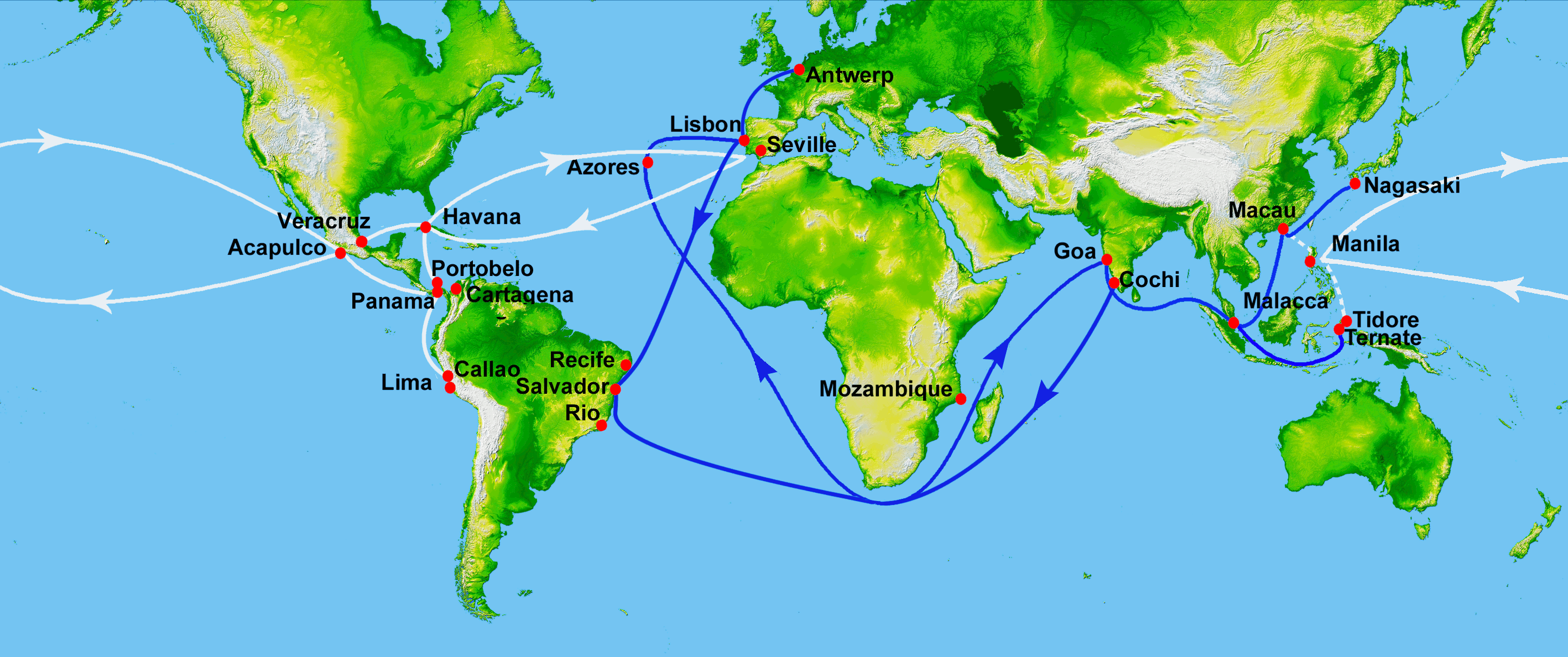
Map showing main Portuguese (blue) and Spanish (white) oceanic trade routes in the 16th century, as a result of the exploration during the Age of Discovery.
|
| Date | (UTC) |
| Source | |
| Author |
|
| This is a retouched picture, which means that it has been digitally altered from its original version. Modifications: depiction of 16th century Portuguese and Spanish trade routes. The original can be viewed here: World Topography.jpg:
|
This image uses high-resolution digital topography data from NASA's Shuttle Radar Topography Mission (SRTM) at JPL-Caltech [1]. It is in the public domain in the United States.
|
 | |
Original upload log
This image is a derivative work of the following images:
- File:World_Topography.jpg licensed with PD-USGov-NASA-SRTM
- 2009-03-17T12:12:25Z Sk 21600x9049 (17145460 Bytes) {{Information |Description=PIA03395: World in Mercator Projection, Shaded Relief and Colored Height |Source=http://photojournal.jpl.nasa.gov/catalog/PIA03395 |Date=February 2000 |Author=NASA/JPL/NIMA |Permission={{PD-USGov-
Uploaded with derivativeFX
File history
Click on a date/time to view the file as it appeared at that time.
| Date/Time | Thumbnail | Dimensions | User | Comment | |
|---|---|---|---|---|---|
| current | 15:50, 15 July 2023 | | 2,835 × 1,188 (2 MB) | wikimediacommons>Hohum | Brighten |
File usage
The following page uses this file:
