File:KTIW approach chart ILS RWY 17.svg
Jump to navigation
Jump to search

Size of this PNG preview of this SVG file: 388 × 599 pixels. Other resolutions: 155 × 240 pixels | 311 × 480 pixels | 498 × 768 pixels | 663 × 1,024 pixels | 1,327 × 2,048 pixels | 475 × 733 pixels.
Original file (SVG file, nominally 475 × 733 pixels, file size: 955 KB)
| Description |
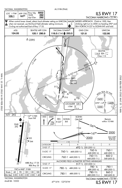
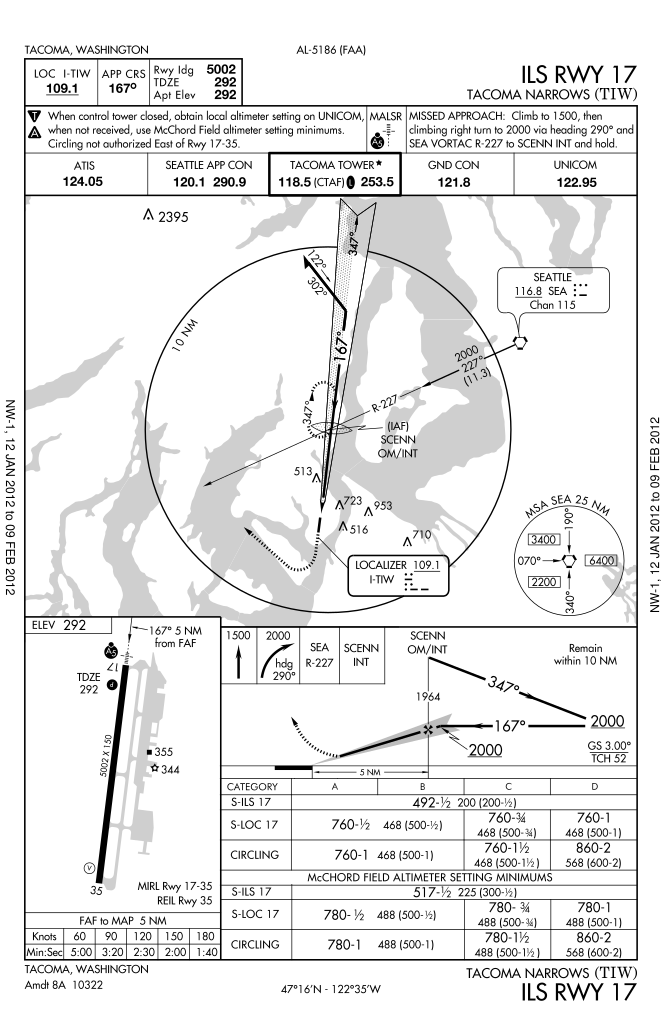
English: Instrument approach chart for ILS RWY 17 of Tacoma Narrows Airport. This chart from january 2012 is possibly outdated – DO NOT USE FOR NAVIGATION. |
|||
| Date | ||||
| Source | 05186I17.PDF at aeronav.faa.gov | |||
| Author | FAA | |||
| Permission (Reusing this file) |
|
|||
| Other versions |
 |

File history
Click on a date/time to view the file as it appeared at that time.
| Date/Time | Thumbnail | Dimensions | User | Comment | |
|---|---|---|---|---|---|
| current | 08:43, 23 January 2012 | | 475 × 733 (955 KB) | wikimediacommons>El Grafo | {{Information |Description={{en|instrument approach chart for ILS RWY 17 of Tacoma Narrows Airport}} |Source=[http://aeronav.faa.gov/d-tpp/1201/05186I17.PDF 05186I17.PDF] at [http://aeronav.faa.gov/digital_tpp_search.asp?fldIdent=&fld_ident_type=FAA&fldCi |
File usage
There are no pages that use this file.
