File:MLS Elevation Guidance.jpg
Jump to navigation
Jump to search
No higher resolution available.
MLS_Elevation_Guidance.jpg (640 × 480 pixels, file size: 46 KB, MIME type: image/jpeg)
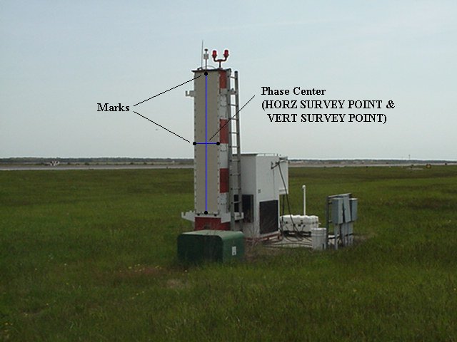
| Description | MLS Elevation Guidance. MLS-EL Horizontal and Vertical Survey Point:phase center. | |||
| Date | Unknown date | |||
| Source | MLSEL.jpg from http://www.ngs.noaa.gov/AERO/navimages/cmanual_mls.html | |||
| Author | USGS | |||
| Permission (Reusing this file) |
|
File history
Click on a date/time to view the file as it appeared at that time.
| Date/Time | Thumbnail | Dimensions | User | Comment | |
|---|---|---|---|---|---|
| current | 17:40, 7 November 2006 | | 640 × 480 (46 KB) | wikimediacommons>Dual Freq | {{Information |Description=MLS Elevation Guidance. MLS-EL Horizontal and Vertical Survey Point:phase center. |Source=[http://www.ngs.noaa.gov/AERO/navimages/MLSEL.jpg MLSEL.jpg] from http://www.ngs.noaa.gov/AERO/navimages/cmanual_mls.html |Date=Unknown | |
File usage
The following page uses this file:
