Waypoint

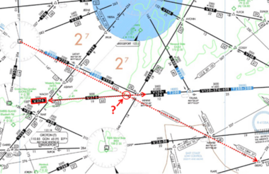
In aviation, a waypoint is a defined geographic point on a flight path, used for navigation, route planning, and ATC communication. It's a reference point, typically defined by latitude and longitude coordinates. Waypoints have been evolving from early aviation navigation methods to the modern use of GPS and flight management systems.
Historical Evolution
- Early Aviation
Early pilots used landmarks, compass bearings, and visual cues for navigation. Waypoints were essentially designated landmarks or points along a route.
- Radio Navigation
As radio navigation technology developed (VOR, DME), waypoints were often defined by their location relative to these ground-based navigational aids.
- Area Navigation (RNAV)
RNAV systems allowed for more direct routes and precise navigation, leading to the use of waypoints defined by latitude and longitude coordinates.
- GPS & Flight Management Systems
Modern navigation relies heavily on GPS and flight management systems, with waypoints defined in these systems and used for route planning and real-time navigation.
Modern Use
- Flight Planning
Waypoints are used to define the route of an aircraft, including departures, arrivals, and intermediate points.
- ATC Communication
ATC uses waypoints to provide instructions and track the progress of aircraft.
- Navigation
Aircraft navigation systems use waypoints to determine the current position of the aircraft and guide it to the next waypoint.
- Reporting Points
Waypoints can be used as reporting points for pilots to communicate their progress to air traffic control.
Types of Waypoints
- Fly-by: The aircraft must turn before reaching the waypoint to intercept the next segment of the route.
- Fly-over: The aircraft must fly directly over the waypoint to continue on the route.
Key Characteristics
- Precise Coordinates: Waypoints are defined by precise latitude and longitude coordinates.
- Names: Waypoints are often given five-letter names for easy identification by pilots and air traffic controllers.
- Flight Path Definition: Waypoints define the flight path of an aircraft, especially in RNAV and GPS-based navigation.
